Indianapolis sits on glacial till and outwash deposits left by the Wisconsin glaciation. The terrain looks gentle. Most slopes are man-made: highway cuts, retention basins, commercial excavations along I-465. But the layered silty clays and underlying sand lenses create a deceptive risk. Water seeps through the sand, saturates the silt above, and triggers shallow rotational failures when no one expects it. A deep excavation through these same deposits can destabilize adjacent slopes if the temporary cut geometry ignores pore pressure buildup. Our team runs limit equilibrium models using measured shear strength from local borings—not assumed textbook values—so the factor of safety reflects actual conditions on the north side, downtown, or out near Eagle Creek.
A slope that stands through August can fail in March. Seasonal groundwater rise inside glacial till is the variable most site investigations miss.
Methodology and scope
Local considerations
Indianapolis sits at roughly 715 feet above sea level, on a subtle topographic high between the White River and Fall Creek valleys. The elevation change is enough to create ten- to thirty-foot cuts along roadway expansions and commercial pads in the northeast corridor. A slope failure here does not just delay a project. It can undermine a public right-of-way, expose a utility corridor, or trigger a sediment release into a tributary that feeds the White River. The IBC classifies Site Class D as default when no shear wave velocity data exists, which often governs the seismic coefficient applied in pseudostatic slope checks. We push for site-specific Vs measurements when the cut exceeds fifteen feet and sits above a traveled roadway. The difference between a default Site Class D and a measured Site Class C can mean the difference between a passing and failing slope during the design review.
Applicable standards
IBC 2021 – Chapter 18 Soils and Foundations, ASCE 7-22 – Minimum Design Loads (Seismic), ASTM D1586-18 – Standard Penetration Test, ASTM D4767-11 – Consolidated Undrained Triaxial Compression Test, FHWA-NHI-05-123 – Soil Slope and Embankment Design
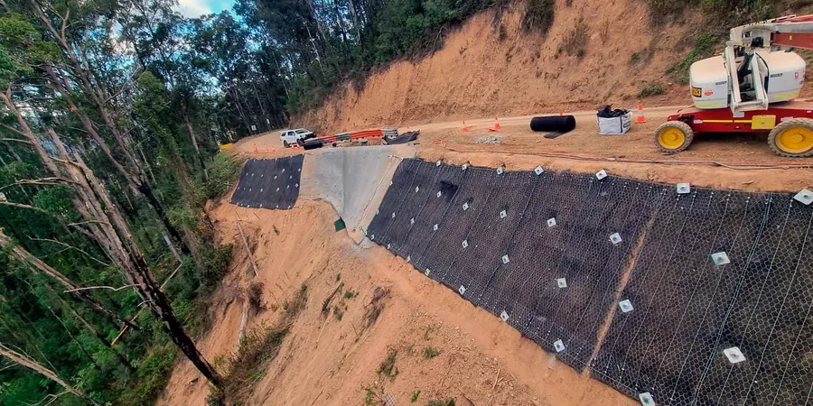
Associated technical services
Glacial Till Slope Assessment
We sample the weathered till, measure Atterberg limits, and run direct shear or triaxial tests at in-situ moisture. The analysis models progressive softening of the near-surface till after repeated freeze-thaw cycles, a failure mode observed in Marion County cut slopes.
Seepage-Driven Stability Modeling
We install vibrating wire piezometers in sand lenses within the till to track seasonal pore pressure. The stability model incorporates transient flow nets rather than a flat water table, producing a factor of safety curve across twelve months—critical for detention basin side slopes that must remain stable during spring melt.
Typical parameters
Frequently asked questions
What triggers a slope stability analysis requirement in Indianapolis?
The Department of Business and Neighborhood Services typically requires a geotechnical report with slope stability analysis when a permanent cut or fill exceeds ten feet in height, when a structure is within a horizontal distance equal to the slope height, or when a slope failure could impact a public right-of-way. The report must demonstrate a minimum static factor of safety of 1.5 per IBC acceptance criteria.
How much does a slope stability analysis cost for a typical commercial lot?
For a site with one or two critical cross-sections, including the necessary borings, lab testing, and limit equilibrium modeling, the cost ranges from US$1,410 to US$4,610. The final figure depends on slope height, access constraints for the drill rig, and whether we need to install piezometers for long-term pore pressure monitoring.
Do you model seismic slope stability for Indianapolis sites?
Yes. We apply a horizontal pseudostatic coefficient derived from the IBC mapped spectral acceleration and the site class. For critical slopes, we may also run a Newmark displacement analysis to estimate permanent deformation under the design earthquake, particularly when the slope supports a settlement-sensitive structure.
What soil parameters do you use for the glacial till?
We do not rely solely on published correlations. We recover undisturbed Shelby tube samples from the critical depth, run consolidated-undrained triaxial tests per ASTM D4767 to obtain effective cohesion and friction angle, and measure in-situ unit weight. For the weathered crust, we run multi-stage direct shear tests on remolded samples at the expected post-construction moisture content.