The 2022 update to ASCE 7 refined site coefficients that directly affect base shear calculations, and in Indianapolis those coefficients can shift a project from Site Class C to D faster than many engineers expect. We started running seismic microzonation campaigns here after noticing that the glacial till and outwash deposits across Marion County produce shear-wave velocity profiles that vary sharply over short distances. A site near the White River often shows a softer upper 30 meters than a site two blocks east on the older till plain, and that difference translates into a 20 to 40 percent jump in design spectral accelerations. The Indiana Building Code references IBC Chapter 16, which sends you right back to ASCE 7, so getting the site class wrong is not just a technical slip — it carries a compliance exposure that reviewers at the Department of Business and Neighborhood Services flag regularly. Our approach ties surface MASW measurements with existing boring logs to build a velocity model that holds up under plan-check scrutiny.
A two-block shift in site class can change design base shear by 30 percent in Indianapolis glacial terrain.
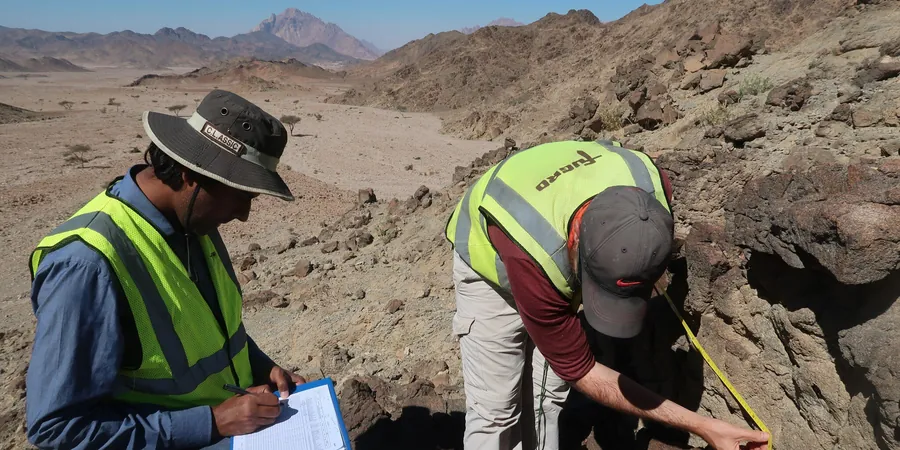
Methodology and scope
Local considerations
Our crew runs a 48-channel Geometrics Geode system with 4.5 Hz geophones spaced at 3 to 5 meters, and we always pair active sledgehammer shots with passive recordings from microtremors to capture the deeper velocity structure below 30 meters. The biggest data-quality risk in Indianapolis is cultural noise — Interstate 70, the CSX rail yard on the near-south side, and even the daily pulse of truck traffic on I-465 can overwhelm the low-frequency end of the dispersion curve if we do not run the passive survey during the quietest window, typically between 11 p.m. and 4 a.m. Poor signal-to-noise at those frequencies leads to an underestimated Vs30, which artificially drops the site class and inflates the design loads. We station an experienced geophysicist on every crew who manually picks the fundamental mode and rejects windows contaminated by transient noise events.
Applicable standards
ASCE 7-22 Chapter 11: Site Classification Procedure, ASTM D4428/D4428M-17: Standard Test Methods for Crosshole Seismic Testing, IBC 2021 Section 1613: Earthquake Loads, USGS Earthquake Hazards Program NSHM 2023
Associated technical services
Vs30 Site Classification per ASCE 7-22
MASW profiling to determine shear-wave velocity in the upper 30 meters, assigned to Site Class A through F with a signed report accepted by local plan review.
Site-Specific Ground Motion Analysis
Probabilistic and deterministic seismic hazard analysis using the latest USGS NSHM, generating uniform hazard spectra and design response spectra for critical structures.
Amplification and De-Amplification Mapping
Grid-based surveys across large parcels or linear infrastructure to map where soft soils amplify bedrock motions, supporting risk-based grading and zoning decisions.
Liquefaction Susceptibility Screening
Integration of Vs data with SPT and CPT logs to evaluate the potential for seismically induced liquefaction in saturated sand lenses within the till sequence.
Typical parameters
Frequently asked questions
What does a seismic microzonation study cost for a typical Indianapolis commercial site?
For a standard commercial project in the Indianapolis area, a microzonation study using MASW with passive array recording runs between US$4,690 and US$19,220 depending on the number of survey lines, site accessibility, and the level of site-response analysis required. A single-line survey for a small building pad falls on the lower end, while a grid-based campaign for a large distribution center or campus-style development moves toward the upper end.
How does Indianapolis glacial geology affect site class determination?
The glacial till and outwash deposits across Indianapolis create a highly variable velocity profile. Dense, overconsolidated New Castle Till can yield Vs30 values above 550 m/s, placing a site in Class C, while adjacent weathered or water-lain deposits can drop below 360 m/s into Class D. Without direct shear-wave measurement, borings alone often miss these transitions, leading to overly conservative or unconservative seismic loads.
Can a microzonation study reduce my structural design costs?
Yes, when the measured shear-wave velocity proves that a site is stiffer than the default Class D assumption commonly applied in Marion County. Moving a site from Class D to Class C reduces the design spectral accelerations by roughly 20 to 40 percent, which directly lowers the required lateral-force-resisting system capacity. The savings in steel, concrete, and foundation size often exceed the cost of the study by a wide margin.