Indianapolis sits on glacial till and outwash deposits that can turn a straightforward excavation into a liability without continuous verification. Chapter 33 of the IBC requires protection of adjacent structures, and the City of Indianapolis DPW enforces strict right-of-way preservation standards. Our approach to geotechnical excavation monitoring layers automated total stations, wireless tiltmeters, and vibrating wire piezometers into a single dashboard that the superintendent and the engineer of record can access from the job trailer or a phone. The White River corridor and the Fall Creek valley add perched groundwater that piezometers catch before the crew sees seepage in the cut. For deeper sites near the Indiana Convention Center or the new apartment towers on Mass Ave, we often pair this with an initial SPT drilling program to define the pre-excavation baseline against which all subsequent movement is judged.
The most expensive alarm is the one that never triggers because the monitoring plan was designed around the wrong failure mode. In Indianapolis glacial sequences, pore pressure kills more shoring jobs than pure overstress ever does.
Methodology and scope
Local considerations
A 14-story mixed-use project on North Meridian Street taught an expensive lesson about what happens when monitoring is treated as a checkbox. The excavation contractor placed inclinometer casings but read them only once a week. Between two readings, a silt seam in the Trafalgar Formation saturated from a water-main leak three blocks away, softening the passive zone in front of the soldier piles. The wall kicked inward 2.7 inches overnight, cracking a sanitary sewer lateral and triggering a stop-work order from the Department of Business and Neighborhood Services. The repair and the delay cost more than the entire monitoring contract would have. Automated readings every 15 minutes would have caught the trend 18 hours earlier, leaving time to install tiebacks at the eighth level before the deformation propagated. Indianapolis has hundreds of miles of aging water infrastructure—Citizens Energy Group reports roughly 400 water-main breaks per year—so the risk of unplanned saturation near a shored face is real and recurring. Monitoring is not about satisfying Chapter 33 paperwork; it is the difference between a controlled excavation and an uncontrolled ground loss that ends up in a claims file.
Applicable standards
IBC Chapter 33 — Safeguards During Construction, Excavation Monitoring Requirements, ASTM D6230-21 — Standard Test Method for Monitoring Ground Movement Using Probe-Type Inclinometers, ASTM D7299-20 — Standard Practice for Verifying Vertical and Lateral Displacements Using Inclinometry, OSHA 29 CFR 1926 Subpart P — Excavations, Competent Person Requirements, City of Indianapolis DPW Right-of-Way Permit Conditions for Monitoring Adjacent Infrastructure
Associated technical services
Automated Displacement Monitoring
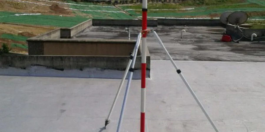
Total station networks tracking prism targets on shoring walls, adjacent buildings, and utility bridges. Data refreshes every 5 to 30 minutes with alerts for lateral drift, settlement, or heave exceeding project-specific thresholds.
Subsurface Instrumentation
In-place inclinometer strings measure lateral deformation behind the shoring, while vibrating wire piezometers track pore pressure changes in the sand interbeds of the Trafalgar Formation and the outwash sequence.
Vibration and Crack Monitoring
Seismographs on adjacent structures during rock hammering or pile driving, plus automated crack meters on brittle façade elements. Compliant with Indianapolis Historic Preservation Commission requirements for projects near designated landmarks.
Typical parameters
Frequently asked questions
How much does an excavation monitoring program cost for a typical Indianapolis basement dig?
For a single-level basement excavation in Marion County with automated total station monitoring, three inclinometer casings, and two piezometers, the instrumentation and monitoring contract usually falls between US$740 and US$2,240 per week depending on the number of readout stations and the reporting frequency. A lump-sum package for a 12-week dig typically ranges from US$8,800 to US$26,900 including installation, data management, and the final close-out report.
Does the City of Indianapolis require a monitoring plan for shored excavations?
Yes. The Department of Business and Neighborhood Services reviews excavation support plans under IBC Chapter 33, and the DPW requires a monitoring and protection plan whenever the dig is within the zone of influence of public right-of-way or an adjacent structure. If the project involves a historic building, the Indianapolis Historic Preservation Commission may impose additional vibration and settlement limits beyond the IBC minimums.
How fast do you get an alarm if the shoring wall moves too much?
Our automated total stations cycle every 15 minutes during active excavation. If the measured displacement exceeds the project threshold—typically 0.5 inches cumulative or a rate faster than 0.1 inches per day—the system sends an SMS and email alert within two minutes of the reading. The engineer on call then reviews the data and contacts the superintendent directly.
Can you monitor groundwater levels in real time during an Indianapolis excavation?
Absolutely. We install vibrating wire piezometers at multiple depths within the borehole, typically targeting sand stringers within the Trafalagon Formation till and any basal outwash. These sensors report pore pressure every 10 to 30 minutes, and the dashboard plots the data against the dewatering pump rate so the contractor can see whether the drawdown is keeping pace with the dig.
What happens to the monitoring data after the excavation is backfilled?
We deliver a final report that includes all displacement, piezometric, and vibration records in both PDF and native CSV formats, plus a narrative summary signed by a licensed professional engineer. That report becomes part of the project close-out package and can be submitted to the City and to the owner's insurance carrier as evidence that the excavation was conducted within the approved movement envelope.